Since the start of 2025, extreme, deadly weather has been one of the nation’s biggest challenges. From winds and fires on the West Coast to snow and tornadoes in the high plains and eastward, Americans are feeling the brunt of Mother Nature.
On Jan. 5, Winter Storm Blair hit the St. Louis region, receiving above average snowfall totals. Although this winter storm did not break any records, this storm dropped the most snow seen in the region since 2013, according to the National Weather Service (NWS). Over its roughly two days, the storm caused dangerous driving conditions and disruptions to daily activity.
St. Charles, Missouri, had the most snowfall at 9 to12 inches, and cities like Kirkwood, Missouri, and Mt. Olive, Illinois, received 6.5 inches.
Winter Storm Blair first made landfall in Washington on Jan. 3, bringing in snow and ice. It traveled across the Rocky Mountains and into the Plains and Midwest before hitting St. Louis on Jan. 5. Bair ended its tour on the East Coast on Jan. 7.
How exactly did Blair form? Blair was a low-pressure system that mixed cold, Arctic air with moisture from the Gulf of Mexico allowing precipitation to fall. The jetstream, a fast flowing air current, also had a role in determining the path of the storm.
The Weather Channel named the storm “Blair” through their storm naming system that looks at the timing of the storm, public awareness and alphabetical naming. Storms switch off between male and female names each time. A similar process occurs for hurricanes as well.
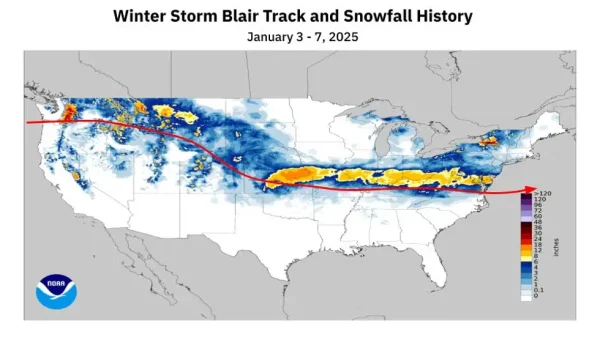
Zooming in to St. Louis, the local conditions were the perfect ingredients for what the region received. Temperatures ranged from the 20s to low 30s, favoring snow and ice rather than sleet.
The region faced many impacts from Blair. The snow and ice made road conditions hazardous, causing at least 436 car crashes and one fatality in Missouri by Jan. 7, according to the Missouri Highway Patrol.
The region’s several school districts were mostly in agreement when it came to school closures due to the inclimate weather. Saint Louis University also closed its doors and paused all campus activities on Jan. 6 and 7.
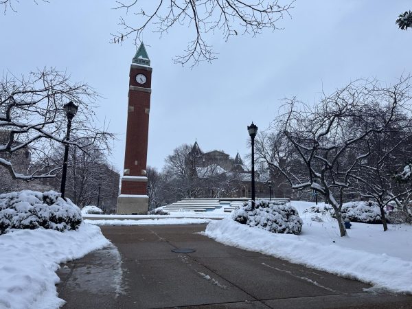
When it came to snow plowing, some Missouri residents felt let down by St. Louis City and the Missouri Department of Transportation (MoDOT) for their preparation and handling of the storm and its impacts.
“As a taxpayer, I don’t understand why that money is not going towards funding for snowplows and the workers,” said Byron White, a frustrated St. Louis resident.
Even with the new investment in MoDOT for plows, many parts of the city still saw multiple inches of snow on the roads as of Thursday, Jan 9.
The city takes care of residential and local streets, while MoDOT clears the interstates and highways. St. Louis City streets with a higher volume of traffic and residents will have a higher priority of being cleared, but days after the storm, some residents are still waiting for their streets and neighborhoods to be plowed. Frustration from the community is growing, but the city continues to ask for patience.
St. Louis has had a history of snowplow worker shortages and tensions, including threats of strikes.
The community faced closed roads, schools and businesses earlier this week, but that would not be the end of it. The St. Louis region once again received more snow from a winter storm advisory on Jan.10. Most cities in the area received 1-4 inches of snow.





Vicki • Jan 13, 2025 at 3:27 pm
Haven’t seen mail in 6 days,crazy
Marnice Blackwell • Jan 13, 2025 at 1:17 pm
You guys do a bad job in cleaning the streets after snow storms, we’re do or tax dollars go not on repaying streets or plowing streets ,the county clean but the city still a problem and it is January 13th .grand ,kingshighway,good fellow are main streets in the city. Then we call about it no answer. Please figure something out before a new storm hits